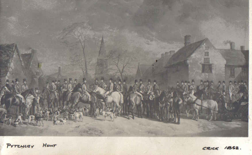
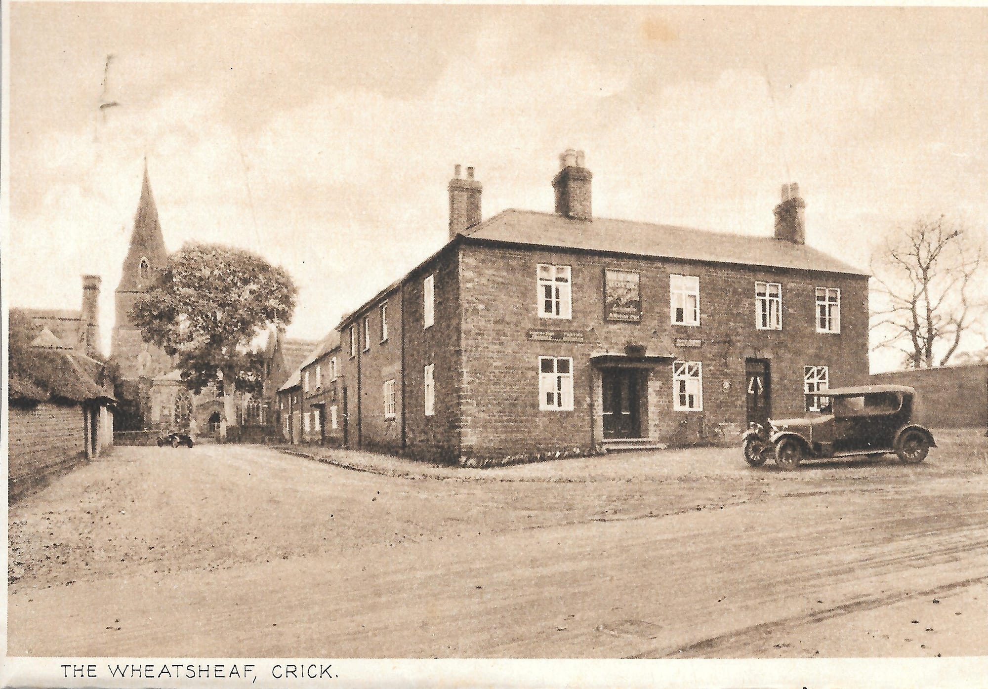
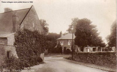
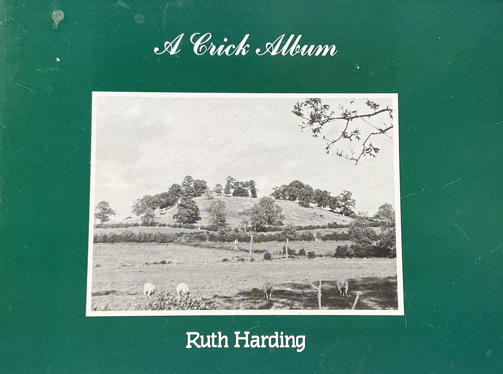
CRICK HISTORY
Devoted to the collection, study and preservation of historic information, together with developing public awareness and education in the history of Crick village, Northamptonshire.
Latest News
Map
The history of Crick
The name 'Crick' probably evolved from the Celtic word 'Kreik', which became Old Welsh 'Creic', meaning a rock or cliff. The village itself is situated on the edge of the Northamptonshire plateau, so that the name 'Creic' is clearly descriptive of the position of the original settlement.
The earliest document, the Geld Roll (1077), and the Doomsday Survey of 1086, have the village spelling as ‘Crec’. According to Gover's 'The Place Names of Northamptonshire' there have been many variations of the name, e.g. Crec, Crek, (1086). Kreic, Creyk, (1201). Creke (1284). Criek (1328). Creek, Creake (1340). Kreke (1517). Creke, Cricke (1598). Creek (1610). Crieke (1618). The variations follow the language changes from Saxon to Norman-French and then old English. The earliest the present day spelling of Crick is seen in 1613.
It seems likely that the village first came into existence in its present location somewhere in the post-Roman period - Watling Street, forms Crick's western parish boundary and traces of Roman buildings have been found within the area of the present-day village, so there has been occupation in this area for a very long time. Earlier still, this area was inhabited by Bronze-age and Iron-age tribal groups, and many traces of round houses from this pre-Roman time have been excavated in a series of archaeological digs around the M1 and DIRFT industrial sites.
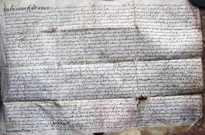
In the medieval and early modern period, Crick was a thriving manor - and thanks to the discovery of Crick's early manorial rolls and other medieval documents in one of Oxford's college archives, we have a unique picture of life in the village between about 1400 and 1700.
Up to 1777 and the implementation of the Enclosure act, farmers owned or rented multiple strips of land, or furlongs, scattered in the 4 great fields which surrounded the village. As these strips were repeated ploughed the middle of the strip became raised relative to the edges giving rise to the ridge and furrow pattern seen in many fields in the midlands. After 1777 the furlong system was replaced by single unified holdings for each of the farmers. Sheep farming was a popular livelihood and where fields were subsequently turned over to grazing the historic ridge and furrow pattern persists in the field surface.
At the time of the Doomsday book Crick had a population of 17 villagers (villeins), 6 smallholders (bordars), 4 slaves (serfs), 4 freemen (sokmen), and a priest. Together with the women and children, who were not counted, the population would have been around 120 people in 32 households, making Crick quite a large village. Later the ‘manor’ of Crick was divided, one third of its income being given as a founding gift to St John’s College, Oxford; the college remains the ‘Lord of the Manor’ to this day, although in name only. The population gradually increased so that by 1720 had risen to 600, living in 128 houses. Sheep farming and the processing and weaving of wool were predominant activities in the village.
But by the end of the century, with the industrial revolution providing large-scale mechanised wool processing and weaving, Crick’s rural wool industry went into decline. Houses were reclaimed and people were sent to the workhouse in the Derry, (then called the Wells).
Despite this Crick continued to be a largely self sufficient rural community through the 19th century with income coming from providing grazing land for the cattle and sheep drovers heading to local Midland markets or London. By 1861 the population of Crick had risen to 999, and a census revealed that there were: - 23 Farmers and Graziers. 3 Wheelwrights. 1 Saddler. 3 Boot and Shoe makers. 5 Innkeepers. 2 Beer Retailers. 1 Brewer. 1 Maltster. 2 Millers. 2 Blacksmiths. 3 Butchers. 3 Bakers. 4 Grocers. 2 Tailors. 1 Rope and Twine Maker. 1 Tallow Chandler and Ironmonger. 3 Builders. 2 Brick Makers. 1 Plumber and Glazier and 1 Surgeon. The woollen industry had completely disappeared by this time. But 50 years on, at the beginning of the 20th century, Crick’s population had dropped to just over 600 as villagers moved into industrialised towns such as Rugby.
Today the village continues to flourish, with an active and caring community. New housing has allowed the population to grow to around 2000 people and good transportation links gives easy access to employment possibilities in the surrounding towns.
In medieval times cottages were distributed along two roughly parallel streets. One was the present High Street-Church Street alignment. The other, to the east, was roughly along the line of Boathorse Lane, Lauds Road, Bury Dyke, and the footpath to Drayson Lane.
Early dwellings were very simple huts, built from timber, wattle and daub or cob (dried, unfired clay mixed with chopped straw) with a thatched roof and unglazed shuttered windows. Crick however did not have any woodlands and so structural timber, especially hardwoods like oak, became scarce from about the mid 1500s and so by the 17th century building in stone became the norm and beams joists and rafters were often recycled from older demoished buildings. Until the 19th Century, when long distance transportation became possible with the canals and trains, building materials had to be locally sourced. Everything for house building came from a few miles radius of the village and could only be moved by horse and cart. Quarries were opened around the village to extract the local brown ironstone that was used in many of Crick buildings of the 1600 and 1700s. There were no building plans other than in the minds of the resident craftsmen and their apprentices and this, together with the availability and use of local materials, gives rise to the unique character of the village technically referred to as being ‘vernacular’ (literally 'of the place'). Roofs were thatched using reeds harvested from the local wetland, which still partially exists today behind the Eldonwall Industrial Estate and near the motorway.

In the late 1700s onward brick was used for house building, again locally sourced from brick pits and over 3 million were also supplied to construct the Crick tunnel for the canal. The brickyards in Crick continued to thrive up to the early 1900s.
With the development of mass transportation, housing stock and design becomes more generic, no longer vernacular. This is called 'polite' architecture - buildings of non-local style designed by an architect. Thatch was replaced by Welsh slate or tiles and house styles particular to a period become recognisable throughout the country:- Georgian, Victorian, 1930’s, 1960s, up to the present day. Examples of most of these polite styles can be seen in the village today.
With the exception of the St Margaret of Antioch Parish Church, which is grade 1 listed, there are 46 other grade 2 listed constructions, mostly houses dating from the 17 and 18th centuries, in Crick. The centre of Crick is designated as a "Conservation Area" by the local Planning Authority.
The canal came in 1814, and thrived for over 100 years. The wharf supplied coal and lime from the Midlands for Crick and the surrounding villages, and other goods from London. 
The railway followed in 1884 but our railway station, which was shared with neighbouring Kilsby, closed 80 years later in 1964. 
During that period all manner of domestic and agricultural goods were sent via the goods yard and there was a regular passenger service to Rugby and Northampton. The station supplied the local storage warehouse during the ‘Cold War’ period and later material for building the M1.
Watford Gap has carried major transport routes for 2000 years, from the Roman Watling Street to the M1. The railway and canal also share this route, which has brought trade to the area from early times and continues today with the logistics park, the 'Daventry International Rail Freight Terminal' (DIRFT), and the M1. However the arrival of the M1, DIRFT, Costco, and Eldonwall has brought with it unwelcome visual, light and noise pollution which affects the entire village.
Amongst the many past residents who have left their mark on Crick are Archbishop Laud (the rector of Crick who became Archbishop of Canterbury), George ‘Cabin’ Smith (the champion of canal children), Thomas Edward Marson (farmer, painter and sportsman), Jack Haswell (world motor cycle champion), Gerald Le Champion (racing driver and pilot) and more recently the 1960’s pop group The Fortunes.
Crick remained an agricultural community into the mid-20th century. Today it is home for many industry and service workers in the region. Crick has a considerable number of recorded historic features. However, over recent years there have been several substantial housing developments which have increased the village size beyond what would have been expected. Further uncontrolled development will have an adverse effect on the historic character of the village, parish and community. For the history and heritage of the village to be preserved, future growth must be appropriate to maintain the rural context and feel of the village.
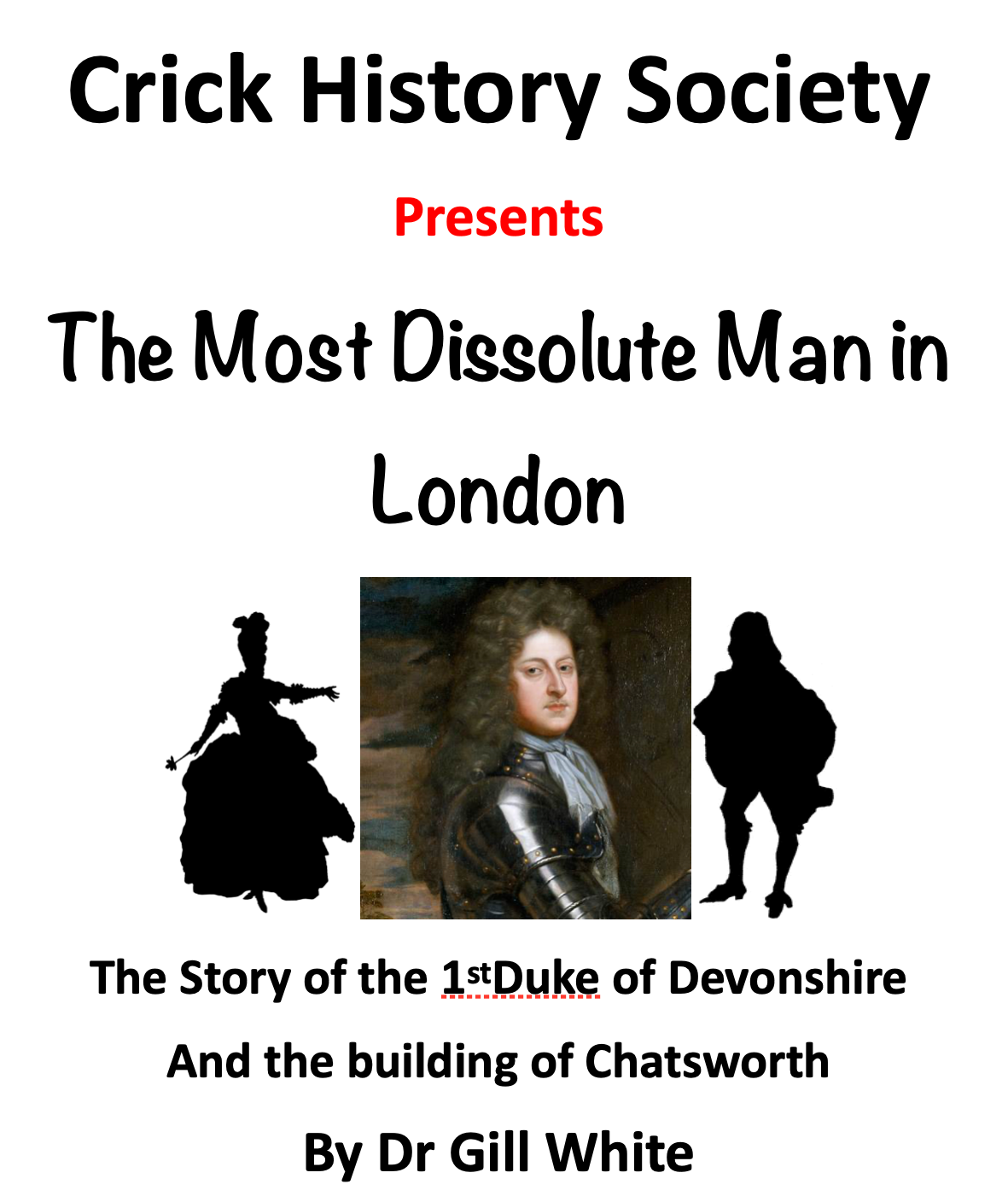
Programme of Meetings
We meet normally on the second Wednesday of the month at 7.30 pm
at the URC Chapel rooms
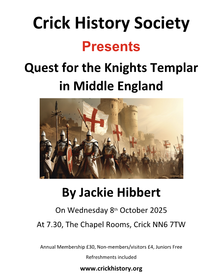
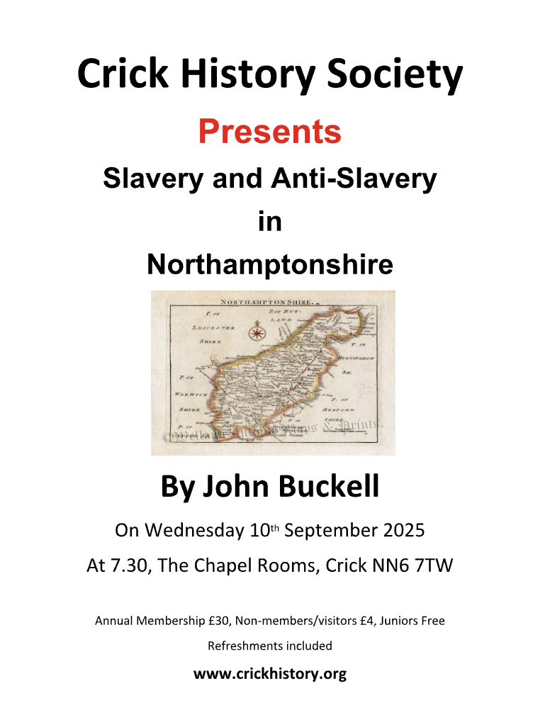
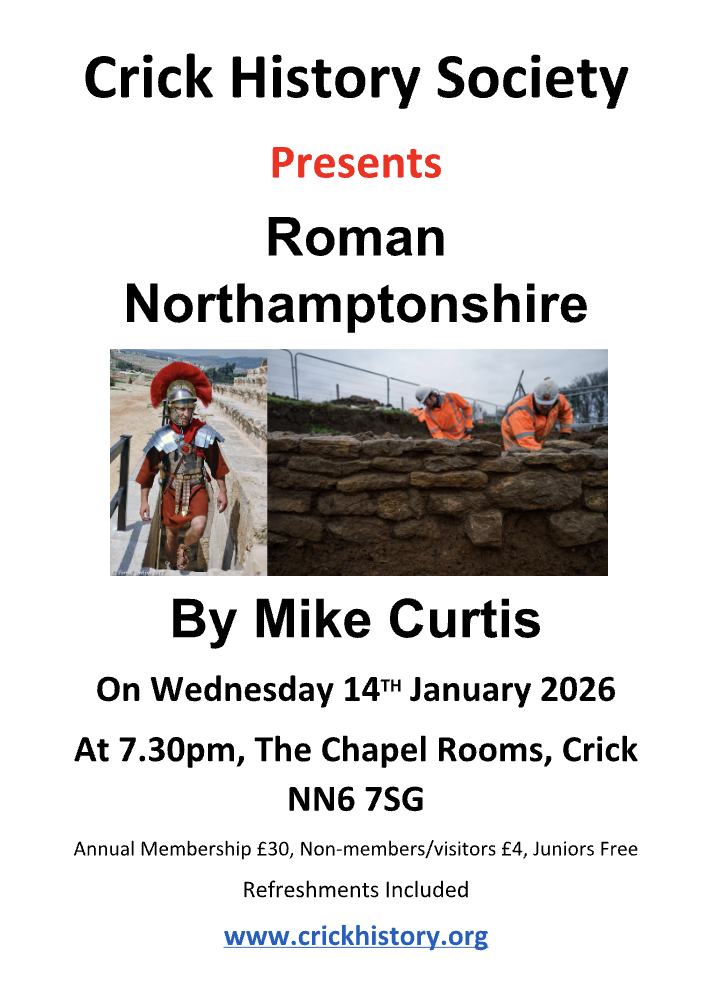
| 14 th Jan | Roman Northamptonshire Mike Curtis |
| 11 th Feb | Richard III Steve Dimmer |
| 11 th Mar | AGM at 7pm followed by Capability Brown, Hero or Hooligan Michael Brown |
| 8 th April | The County Buildings in Northampton Richard Blacklee |
| 13 th May | Crime and Punishment in 19 th Century Ann Langley |
| 10 th June | Women’s Land Army During FIRST World War Helen Frost |
| 8 th July | The Men Who Killed The King (The Regicides) Jay Phelps |
| 12 th Aug | Group Outing TBA |
| NOTE: Friday 11 th Sep | An Evening with Margaret Thatcher Lesley Smith |
| 14 th Oct | The Role of The Barber Surgeon (Wars of the Roses) Eddie Smallwood |
| 11 th Nov | The Secrets and Scandals of Canons Ashby Laura Malpas |
| 9 th Dec | Christmas Dinner |
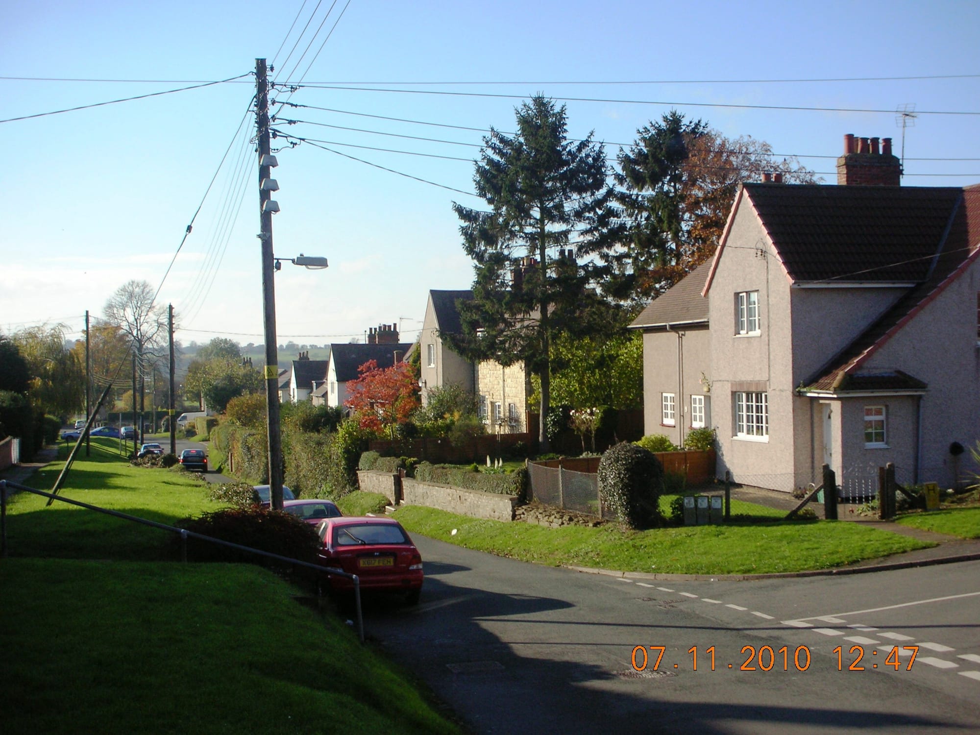
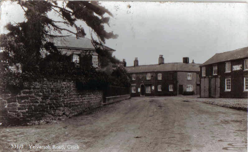
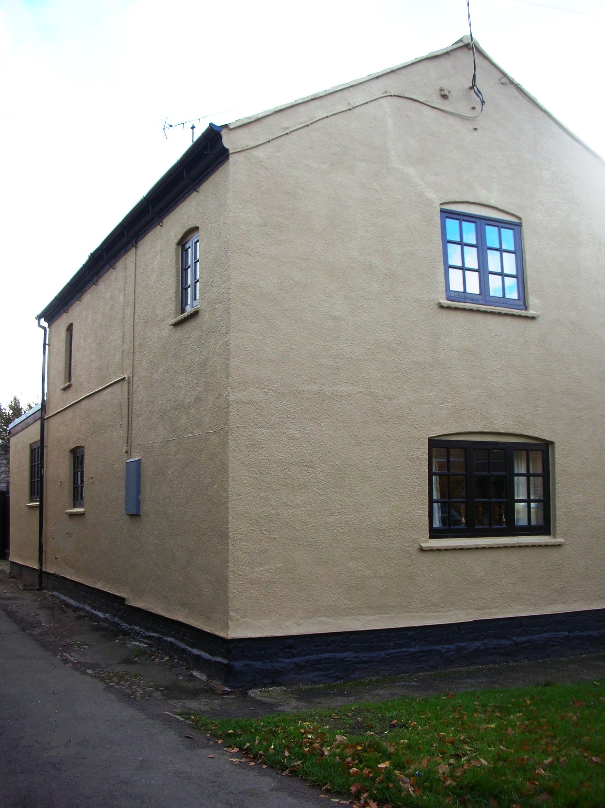
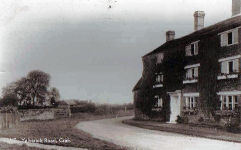
NOW & THEN
SOME IMAGES FROM THE ARCHIVE Move the cursor over the eye on the centre of any picture for the place & date. Click on any picture to enlarge the image. Please note our Download policy.


society origins
Thus the Crick History Society got under way with the aims of:
- encouraging an interest in the history of Crick village
- researching and sharing knowledge of the history of Crick
- creating a record of the history of Crick village and establishing an archive of that information for future generations
- organising meetings and events of historical interest for the benefit of members and others
- and promoting contact with other Local History Societies, Associations and responsible bodies.
Please contact us if you have something you think might be of interest to the Society:- documents, photographs or postcards, artefacts (or even an old house!).
We will be very pleased to hear from you.
(Email the Society)
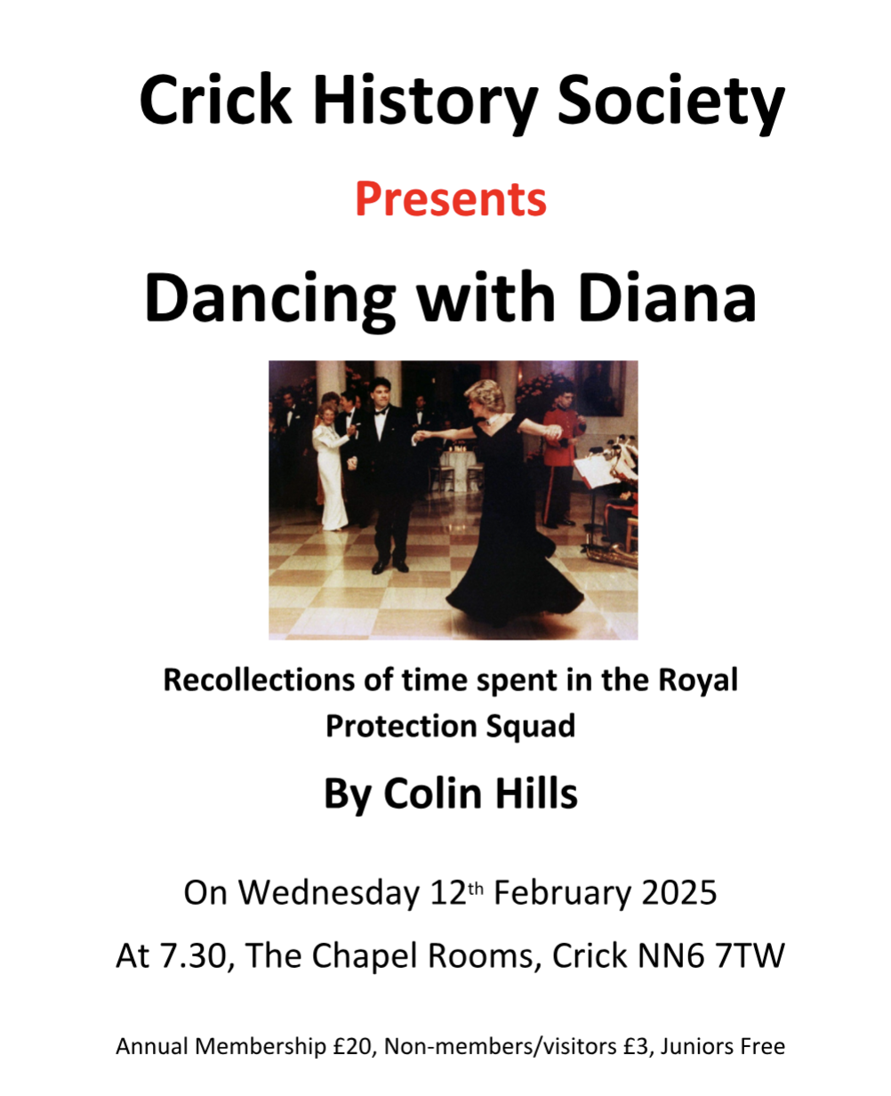
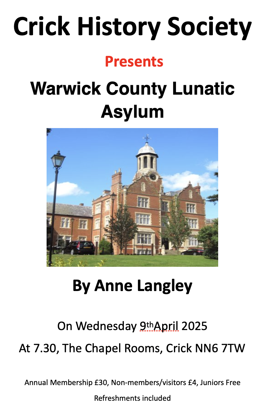
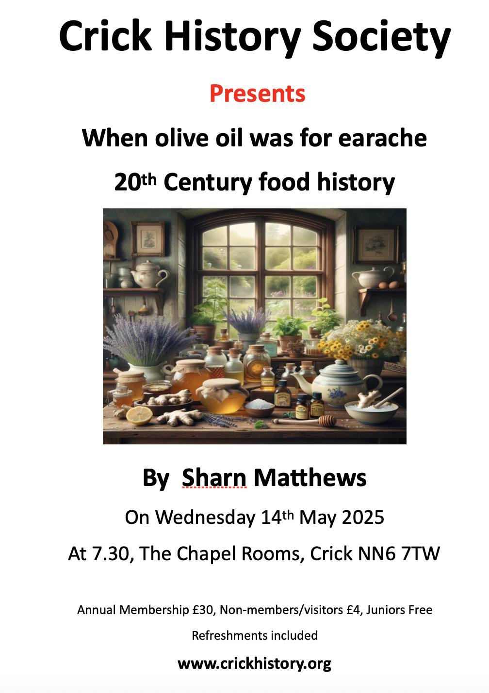
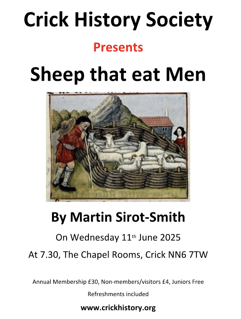
Previous meetings
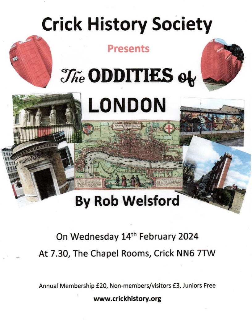
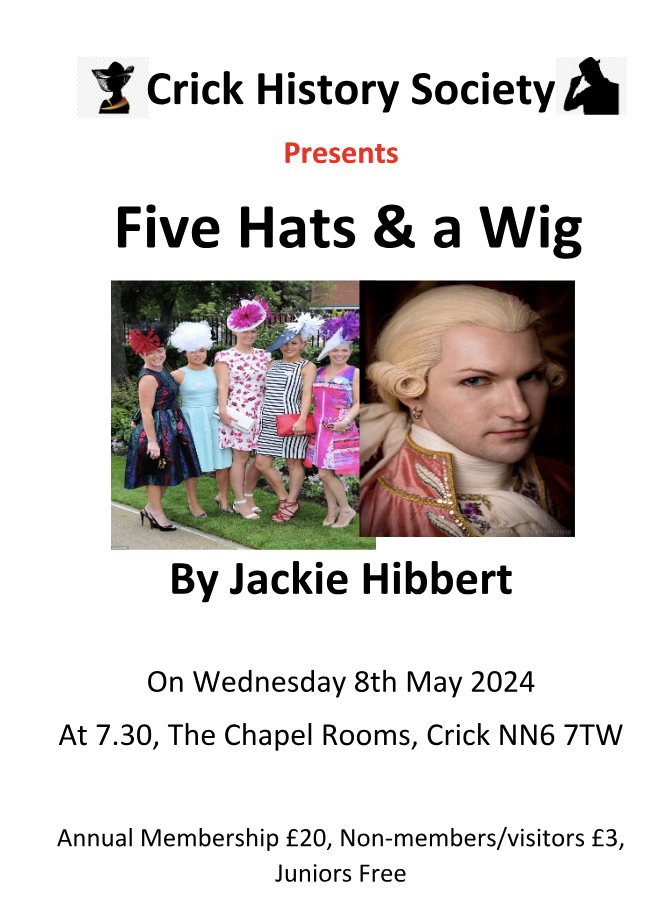
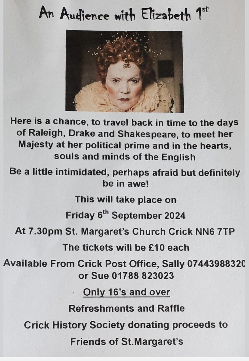
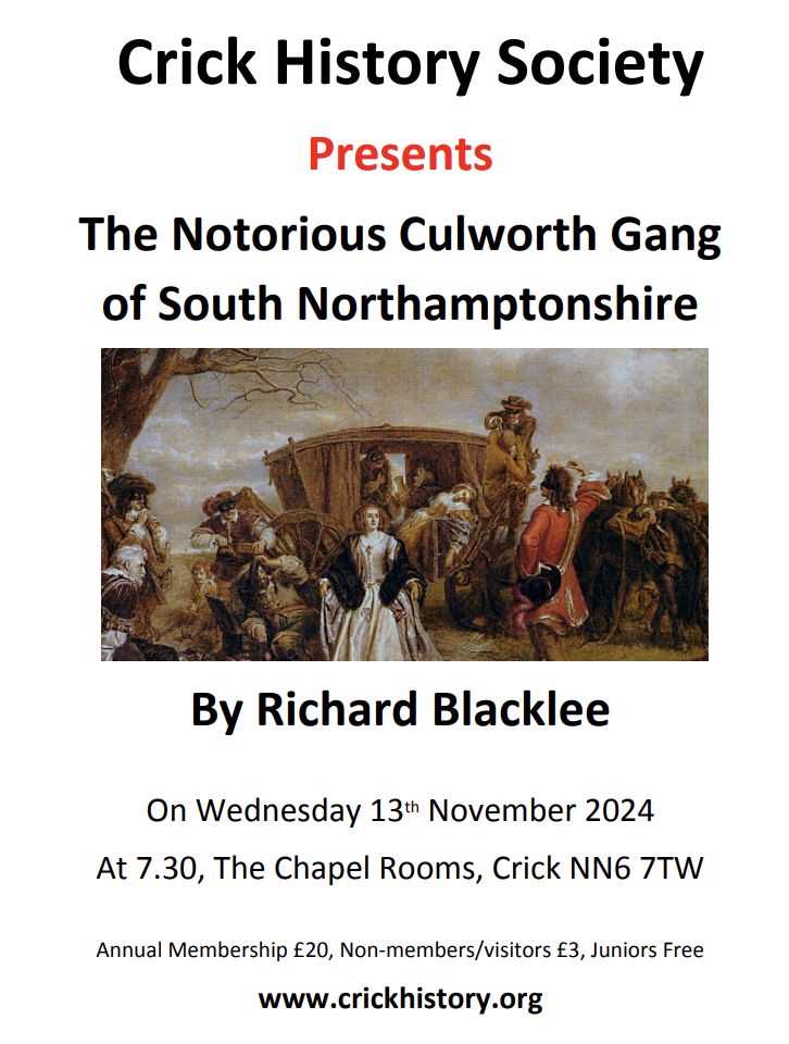
Some of the posters which advertised our talks and were displayed around the village prior to a meeting. Click left or right to scroll through.


projects
Image Library.
One of the first large-scale projects undertaken was the systematic collection and digitisation of as many old photographs, postcards, letters and other early visual records as possible. This is an ongoing project, more information can be found by clicking here.
House History
House history work involves the study of all available documentary records for a particular property and its successive owners, plus careful study of the form and construction of the property and its associated outbuildings where relevant. This is an ongoing project, more information can be found by clicking here.
May Day.
A project to record the names of all May Queens (and their Attendants, Heralds and Knights) since the first recorded appointments in 1931; this project is ongoing and needs recent appointments to be added.

(May Queen procession down Church St in 1928).
War Memorial.
This ongoing project provides information about each name on the Crick War Memorial, so that their sacrifices are not forgotten. A book is available on the work carried out so far -'Crick's Roll of Honour' – which records those who did not return. The project could be extended to include those from Crick who went to war and returned. This part of the project has yet to be started.
Footpaths and Heritage Trail.
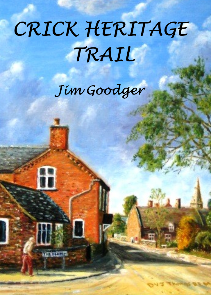
Routes through the village and footpaths to the parish boundary are described, together with points of historic interest. The information, together with a contextual introduction about the village, was published in two books entitled 'Walks & More' and 'Crick Heritage Trail'. Thanks to energetic volunteers willing to walk the routes, Jim Goodger has updated the out of print Walks & More book. The reprinted 'Walks & More -Rewalked' book is available in Crick Post Office.
Crick News 'History Matters'.
Part of the work of the History Society is to provide History notes as a regular feature in Crick News. This is ongoing.
Crick People.
A collection of illustrative biographies of a few of Crick's colourful people, reflecting the development of the village's character through the ages. The book includes three Lords of the Manor, an Archbishop of Canterbury, several rectors - some of them good, some not so good! - a champion of impoverished canal children, a local artist, a motor cycling champion, a racing driver and pilot, the first 'gong' man, a pop group, an industrialist, and a Crick Treacle Miner - all in 'A Few Crick People', available from the Post Office.
Oral histories.
We are beginning to collect conversations with long lived Crick residents to gain a personal sense of what life was like in the village in former times. If you would like to take part then please contact us.
Information Boards.
 As you walk through the village you will see some heritage boards with information provided by the Crick History Society. We will continue to be a source for such information as and when required.
| In the Village: | In the Parish: |
| Washbrook (Sheep washing) | Crick Railway Station (A5 - DIRFT) |
| Washbrook (Turnpike Milestone) | Shenley (DIRFT - Railport) |
| St Margaret's View (Iron Age settlement) | |
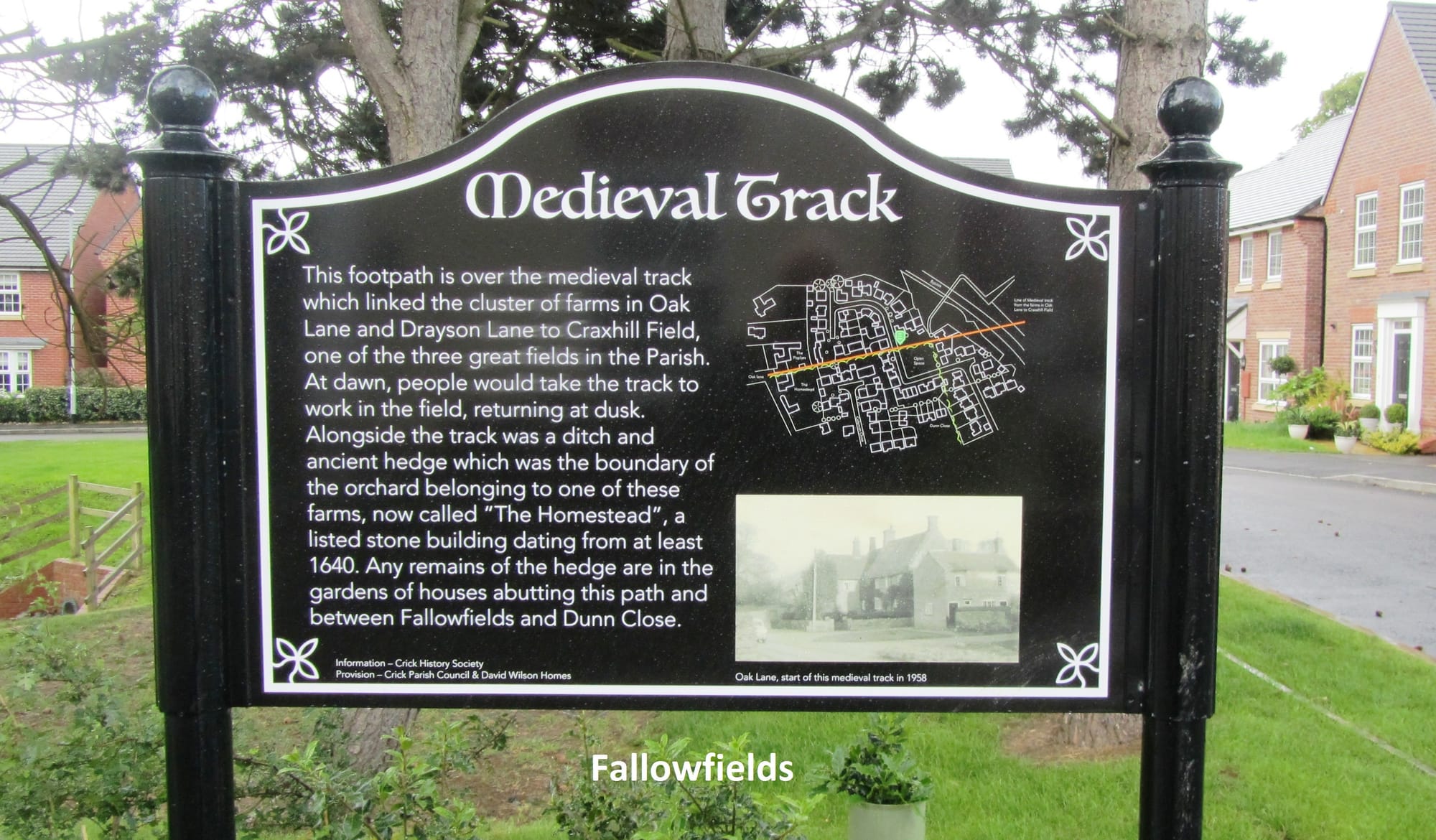
| Fallowfields (Medieval Track) | |
| Crick Wharf (Celebrating 200 years of the canal) | |
| Elms Farm Public Open Space (Village Centre)-awaiting |
200th Anniversary of Crick Canal.
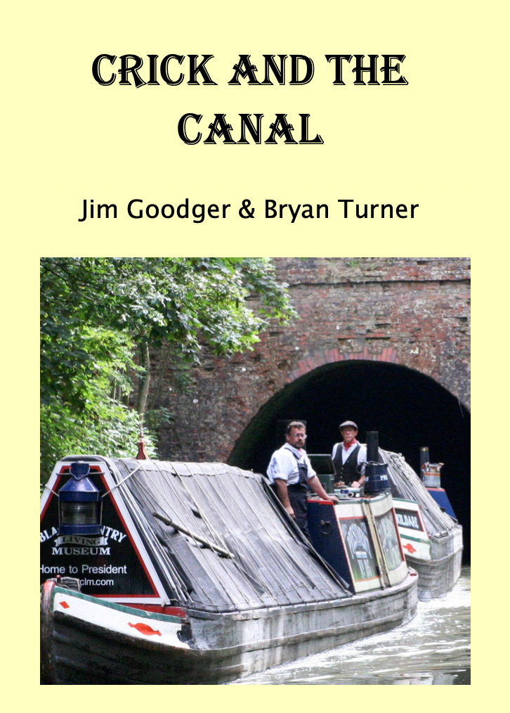
The Crick History Society organised a weekend on 9th and 10th August 2014 to celebrate the 200th Anniversary of the official opening of Crick Tunnel and the canal at Crick on 9th August 1814. The original opening had been attended by Canal Company worthies. This time the local dignitaries included the Chairs of Northamptonshire County Council, Daventry District Council, Crick Parish Council and Vice-Chair of Market Harborough District Council plus the Chief Executive Officer of Canal & River Trust. A plaque was unveiled at the start of two days of celebration which included displays of canal arts, craft and antiques and demonstrations of working canal horses. Crick History Society mounted an exhibition of the canal, tunnel and wharf, which was supported by re-enactor Andrew Ashmore taking the role of Benjamin Bevan the civil engineer for this arm of the canal. The restored President and Kildare working boats, from 1908 demonstrated what living conditions were like for working boat families and the President's steam engine interested many of the visitors. A main attraction was being taken through the tunnel by boat and carried back to the wharf in a 1929 Midland Red charabanc. The event was funded by generous support from the Northamptonshire Community Foundation and Tim Langer, the then owner of Crick marina. A book - Crick and the Canal - has been produced to record the history of the canal in Crick Parish and the celebration. It is available to buy from Crick Post Office.
Mapping the graveyard of St Margaret of Antioch.
Until now there appears to have been no map or records relating to where the historic graves are situated in the closed graveyard. There are many graves which are now unmarked and others have gravestones of a stone that has eroded with time making then unreadable. The readable gravestones were logged by the Rugby Family History Group in 2009 but this needed to be mapped onto the graveyard.
A study in September 2023 to map the gravestones is now available as a downloadable PDF and all the readable headstones can now be located both on a map and in the graveyard using a coordinate scheme.
(The picture below is a sketch of the church done in 1755; with rather fewer graves than today)

Crick today.
Today is tomorrow's history. Whilst we have information, news items and photographs of yesteryear in our archive, in 50 yrs time what will be there about today? This is the basis of this project, to collect and collate present day information.
House deed transcription.
Nationally, house deeds are being phased out and with it the loss of the history of the houses they recorded. We have photographic records of a number of the deeds of Crick houses which we would like to have typed up and made searchable so their full value can be utilised.
Publications about Crick
'Crick's Roll of Honour', 'A few Crick People' and 'Crick and the Canal' are still available, from Crick Post Office. 'Who's the Fool', the story of Edward's Restaurant is available on Amazon e-books. A free downloadable copy of the Historic Village trail leaflet is available. There is also a downloadable copy of the Mapping of St Margaret of Antioch graveyard study. A new edition of the "Walks and More" book is now available from Crick Post Office.


Two YouTube videos have been published on
'George Smith of Coalville' -about Cabin Smith
- https://youtu.be/ar_sukwvlnA?si=U45jYAXFYpYuFWtw
and 'The Old Doctor of Crick' about Dr Smith -
https://youtu.be/vsXyShFJtQo
which were linked to the 100th anniversary of the Crick Club for Ex-Servicemen in 2023.
Crick Historic Village trail Leaflet
Crick Historic village trail leaflet
The pdf can be downloaded, double side printed on standard A4 paper, and folded to form a leaflet describing a walking trail around Crick village, pointing out places of historic interest A free copy can also be picked up at Crick Post Office and most of the village pubs. "I’d just like to say how much I have enjoyed visiting Crick with the aid of your Historic Village trail and the information on this site. Thank you" Chris Long
St Margaret of Antioch Crick graveyard
St Margaret of Antioch Crick graveyard
A downloadable PDF file of a study by Crick History Society to map the readable gravestones in the closed graveyard of Crick Parish Church.
CRICK DIGITAL ARCHIVE
Topics covered in the Information Archive include:
Census database
Parish Records
Poll Books
Hearth Tax
Inclosure
1910 Valuers Book
Births, Marriages & Deaths
Ancestry - click here for further information
Crick Books & studies
Charities
Newspaper cuttings
Local Administration
Directory Entries (Bridges, Harrods, Kelly, Whellan, Bennett, Rugby Almanac, Post Office, etc)
Crick History Society
St Margarets Church, Bells and Rectors
United Reformed Church
Shenley
John Bridges - 1721 description
Crick Feast
Canal
Wills - click here for further information
Image Library
Click here for further information and also refer to the Now & Then section
House Histories
Click here to see the houses covered
Other Material Shared
Local historian, EW Timmins Archive related to Crick
Local historian, Gren Hatton Archive
Northamptonshire Archaeologist, David Hall articles related to Crick
Local historian, Dr Rabould information related to Crick
Librarian, St John's College Oxford, Lord of Crick Manor
Contact the Archivist for further information
IMAGE LIBRARY
We now have nearly 750 photographs shared by 50 people.
In order to keep track of the provenance of every image, they are grouped in a series of "image galleries", and each gallery corresponds to one of the donors. New image galleries are regularly added.
Please contact the Archivist if you are able to share any material.
ANCESTRY
In addition to detailed parish register for Crick, we can search through Hearth Tax returns (1660s-1670s), Enclosure Awards and Militia Lists (1770s), census returns (1841 to 1910), transcripts of wills (1500-1700) and other records. These aids are not yet available online - and in some cases there are technical and/or copyright reasons why they cannot be put online - but a certain amount of voluntary research can be undertaken, and this is conducted by email (see contact details below).
You can search the Crick parish registers between about 1540 and the early 1900s yourself, by visiting our partner website at Rugby Family History Group, which holds searchable copies of our transcribed databases of baptisms, marriages and burials for several west Northamptonshire villages. (However, you will need to join the group as a paid-up member if you want to use this search facility.)
Crick village family names:
Many Crick names go back a long way - in some cases we may be able to trace a family name back for several hundred years. However, Crick's location close to a network of busy railway and canal routes means that there have also been many transients among the village population, particularly during difficult periods such as wartime, and during the construction of the canals and railways in the late 1700s and early 1800s.
It is well worth checking some of the other local villages, as families in the past moved quite regularly between villages (especially if they were land-workers or labourers or had other occupations that caused them to change their place of work) and often had one or more of their children baptised, married or buried in a neighbouring village.
Over the years we have been able to share some family names with researchers. Because of this we have been able to extend our family knowledge base which can be made available to researchers, providing of course the party(ies) agree.
Check out the house histories section
Information on the histories of specific houses - and the people who lived in them over the years.
Amongst the data recorded for each house (usually as a result of searching through the house deeds) is a list of the owners and/or occupants at different dates - and this can sometimes be helpful in tracing a family history.
Don't forget to check the house histories for any houses in other neighbouring villages for which house-history records have been compiled.
Confidentiality:
Any contact that we receive from you will be treated in strict confidence. Information sent to you will not be divulged to any other party without your prior approval. We use a simple but secure process for handling contacts with possible third parties, as follows:
- If we know that someone else is researching your family name(s), we will first notify you of this, and ask you if you wish your email contact details to be passed to the other party or parties.
- If you confirm to us by email that you are willing (and on that basis only), we will pass your contact details to the other party or parties. It is then up to them whether or not they wish to contact you.
Simply email the Archivist in the first instance, giving brief details of any name(s) and date(s) in which you are interested.
download Policy
Downloads (and legal copyright)
You may download and store any of the above files on your own private computer and for your own private use, subject to the following conditions:
1) The copyright in this website and the material on this website (including without limitation the text, computer code, artwork, photographs, images and any other material) is owned by us. You must not adapt, edit, change, transform, publish, republish, distribute, redistribute, broadcast, rebroadcast or show or play in public the material on this website (in any form or media) without our prior email permission.
2) You may however request permission to use any item(s) of copyright materials on this website by contacting us, quoting the file-ID reference(s) and description(s) of the material in question, and stating the purpose(s) for which you wish to use it.
3) We give no warranties or representations concerning the material downloaded, and accept no liability in relation to the use of it.d any content such as text, images, links, etc. You can edit all of this text and replace it with what you want to write. Use the advanced editor to design this content page.
HOUSE HISTORY
An important aspect of any village history site is the investigation and documentation of the village's vernacular architecture. This is often referred to in short as "house history work", and it involves the study of all available documentary records for a particular property and its successive owners, plus careful study of the form and construction of the property and its associated outbuildings where relevant.
In Crick, a conscious decision was taken to carry out a large-scale house history project for as many as possible of the village's historic buildings within the scope of a formal project, which is referred to as the 'Crick Historic Building Record'.
The Crick Historic Building Record
The aim of this project is to investigate and document the history of Crick's older houses, based on analysis of surviving property deeds, study of wills and other documentation about the people who lived in the houses – and of course, detailed examination of the properties themselves, both as they are today and via old maps and photographs.
Information in the deeds is checked and expanded via other documentation such as parish registers, Enclosure Awards, Land Tax returns, Land Surveys, census returns, wills etc., much of which can be found at the local county record office. This in turn permits educated guesswork about the dates at which changes were made to the fabric of the buildings – a large house partitioned to allow part to be let to lodgers, two adjacent houses knocked together to accommodate a growing family, an extension added, a barn converted into living space, some land sold off or acquired, and so on.
The Crick Historic Building project commenced in 2010, and it is expected that it will take many years to process and analyse the mass of detailed documentation that has been generously made available by the owners of many of Crick's oldest houses. In due course, a series of detailed house-histories will emerge from this analysis work, providing a unique insight into the development of the whole village over the last 2 or 3 centuries. In the meantime a "House History Recordl" document is available for every house or property so far examined.
Recent changes in English property law
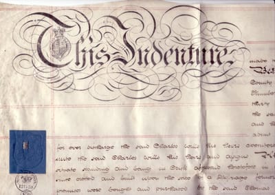
The work to record and copy old deeds is especially important today, because recent changes in English property law have abolished the need for mortgage lenders to hold a copy of the property deeds as security for their loan – and further legal changes have meant that even the Land Registry does not now hold copies of old property deeds. The result of these legal changes is that, since about 2003, increasing numbers of solicitors, building societies and banks have been steadily destroying hundreds of thousands of old parchment and paper property deeds dating back to the 1800s, the 1700s, and in some cases back to the 1600s. It may seem incredible that such an enormous body of valuable historical material can have been casually earmarked for destruction in this way – but such is the case, and for many of our old village and town houses it is already too late to discover their history, for their deeds have been lost or destroyed.
Confidentiality
Any information that we receive from you will be treated in strict confidence. Information made available to us will not be divulged to any other party without your prior written approval. This particularly applies to:
Digital images of any deeds and associated documents made available to us (and in addition, we expressly do not record any recent property documents, or any sensitive financial or similar information).
Digital images of the interior of any property (and in addition, we expressly do not record any images that might endanger the security of the premises if made more generally available).
How to contact us
We are always willing to look at further documents, if the owners of a house are kind enough to let us see the early deeds to their property – just contact the Archivist by email in the first instance.
Capturing the Data
Many guides have been published to assist would-be house-historians. In practice, the historian can only use whatever evidence is available, however. So these web pages do not claim to be an authoritative version of How to Do It; it is merely a reflection of what information was available.
Basic Methodology
The method adopted involves three main stages of investigation
- Examining the deeds to the property
- Physical examination of the property
- Gathering data from other sources
Property deeds should first be photographed carefully, using a digital camera with at least 5Mpix resolution. If a separate file-folder is used for each property, and each of the photographs is given a meaningful filename commencing with the date-year of the document (eg: "1754 Crick, mortgage, A Jones to B Smith.jpg", etc), the images will automatically arrange themselves in date order, making it much easier to unravel the evolving story that is told by the documents.
The most useful documents tend to be Abstracts of Title, Conveyances, and Mortgages, because they generally include significant background facts about the owners and occupants.
Understanding the legal terms can sometimes be a challenge (for example, 'lease and release', 'common recovery', 'copyhold or customary tenancy', 'surrender and admission', the various different types of mortaging and arrangements for borrowing, and so on). A good legal reference book can be a great help in explaining such terms in plain English - for instance, "A Concise Law Dictionary" by P.G. Osborn. The Oxford English Dictionary is also a mine of useful information regarding archaic legal and other terms.
When the deeds have been transcribed and analysed, the results can usually be condensed for ease of understanding, into one or two summary sheets; another useful tool is the spreadsheet - especially when combined with family-history data culled from parish registers and other documents, see below under 'Supplementary data sources'.
Physical examination of the property
A physical examination should aim to establish the layout and dimensions of the main building, and any associated outbuildings. A walk around the property with the owner is generally the best method.
Keep an eye open for any special features that might give clues to dating, such as date plates, doorways/lintels, windows/fittings, chimneys (both regarding their form and their position within the house), staircases, ceiling and wall beams, roof timbers, specific period features (such as locks and bars, re-used timbers, decorative features etc), any signs of rebuilding (eg replacing cob with brick, timber framing with stone, raising the height of the roof, etc).
Take plenty of photographs, including close-ups of features of interest. But remember to obtain the owner's permission beforehand - and do not make any of this material public without specific permission from the owner.
Finally, old photographs, sketches, maps and paintings of the property can all be of great assistance in checking the previous history of the building - for instance, helping to establish dates for the blocking of a window or doorway, the addition or replacement of a feature, repair of a roof, etc.
Supplementary data sources
There are so many other potential sources of information that it is impossible to describe them all here in sufficient detail; a list will suffice to indicate the possibilities. Most of the documents can be found in the local county records office, and others (such as old newspaper reports) are now available via online database archives:
- Word of mouth reports
- Parish registers
- Census returns
- Wills and inventories
- Enclosure awards
- Militia List returns
- Hearth Tax returns
- Land Tax returns
- Newspaper reports
- Manorial records
Crick Village House Histories
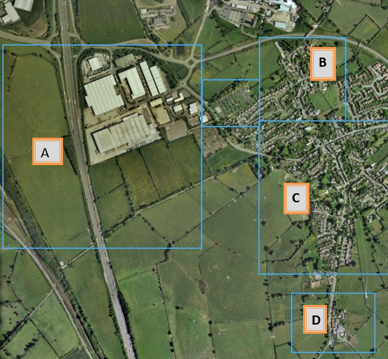
This map shows Crick in more detail. Six areas are highlighted, each leading to more detailed views of the respective areas.
A Medieval Water Meadows
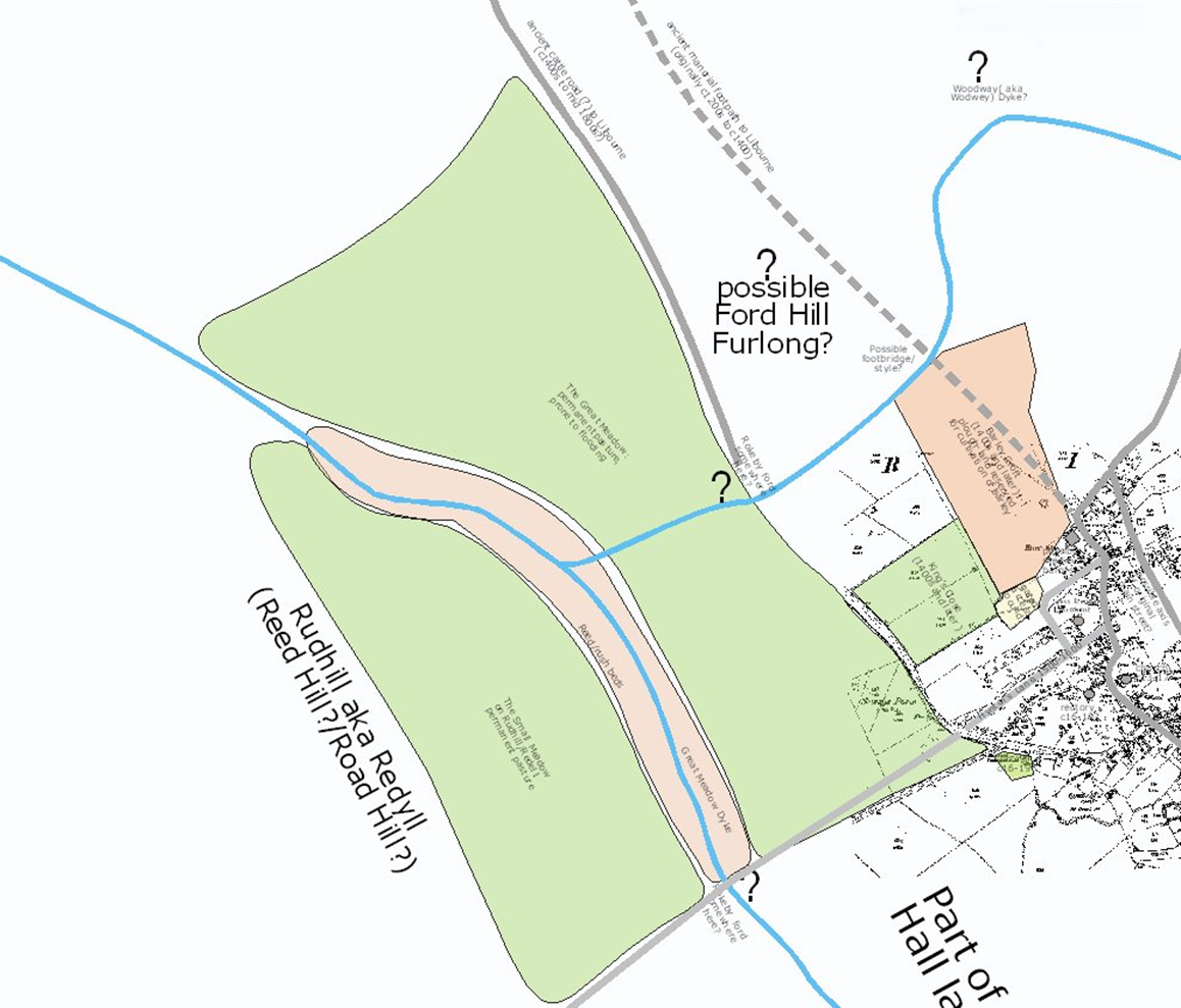
Statements in Crick's manorial rolls throughout the Tudor period make regular mention of 'the great meadow' and 'the rush beds'.
Comparison of later documents (such as the Enclosure Award of 1778) and deeds for land and property dating from the 1800s, together with study of the modern Ordnance Survey map, show that the meadow in question was the low-lying stretch of land west of the village, where streams descending from the eastern and northen slopes come together. This area would have been subject to flooding in medieval times, and thus unsuitable for ploughland; however, it would not have been wasted, but used as valuable pasture in the early spring - an important resource for the village's flocks and herds.
The stream was not culverted, as it is today throughout the modern industrial estate, and its banks were lined in the 1500s with dense clumps of reeds. These reeds also had their use - they were a major source of fuel for the village bake-ovens (for Crick had no woodland at all, and timber was in such shortage in this lordship that the few trees that were growing were never used as fuel, but carefully saved for building material).
The manorial court rolls make regular mention of the reed-beds and the shortage of timber. For example, in 1536 Robert Kylworth was accused of having carried away rushes for fire-lighting, and was fined 12d (about one week's pay); and later in the same year we read that 'No-one may cut rushes except on his own land, on pain of a fine of 3s-4d. Bakers must put out their fires after they have withdrawn the bread, fine 12d.'
B Crick Village North

This map shows the north area of Crick in more detail. House HistoryRecords are available for:
- Bucknills Lane, No. 1
- Church Street, No. 6, (Elms Farm)
- Church Street, No. 10 (Cromwell Cottage)
- Church Street, No. 12
- Church Street, No. 14 (Meadow View)
- Church Street, No. 16
- Church Street, No. 19 (Churchside)
- Church Street, No. 31
- Church Street, No. 33 (Fennel Cottage)
- Church Street, No. 39 (The Hall)
- Drayson Lane, No. 5 (Pytchley Cottage)
- King Style Close, No. 1
- King Style Close, No. 2 (Cranbrook Cottage)
- King Style Close, No. 58
- Oak Lane, No. 5 (Ash Tree House)
- Oak Lane, No. 12 (Oak Cottage)
- Oak Lane, No. 15 (The Poplars)
- Oak Lane, No. 17 (The Homestead)
- Yelvertoft Road, No. 24
- Yelvertoft Road, No. 26 (Ranmoor)
- Yelvertoft Road, No. 15 (Barley Croft)
The Church of St Margaret of Antioch dates back to at least Saxon times. In about 1077 AD the wooden built church, on the site of the preset Chancel, was replaced by a stone building. Over the centuries the church has been extended from its Norman structure with the addi tion of aisles and a spire.
The Doomsday Book (1086) records 32 households in the paish with a population of about 140 including a priest. Because of the numbers, Crick would have been considered a town. Most of the population would have lived beside or near the church.
Over the centuries the population spread out along the Oxford Way. This was the medieval route linking ecclesiastical centres of Oxford, Leicester and Peterborough. The Oxford Way roughly followed the line of High Street, Church Street and Yelvertoft Road.
Following the Black Death (1346 - 1352) many villages suffered from depleted population resulting property and land being laid to waste. This is believed to have happened in Crick and land was subsequently set aside for sheep grazing. The Welsh drovers would rest the sheep on pasture land before moving them on to East Anglia and then Europe. The drovers route through the village passed by what is now Lauds Road, Bury Dyke, Oak Lane and Drayson Lane. During the 16th to 18th centuries, farming and cottage industries of weaving, spinning and wool combing provided a livelihood for Crick people and buildings sprung up along the Oxford Way and drovers route.
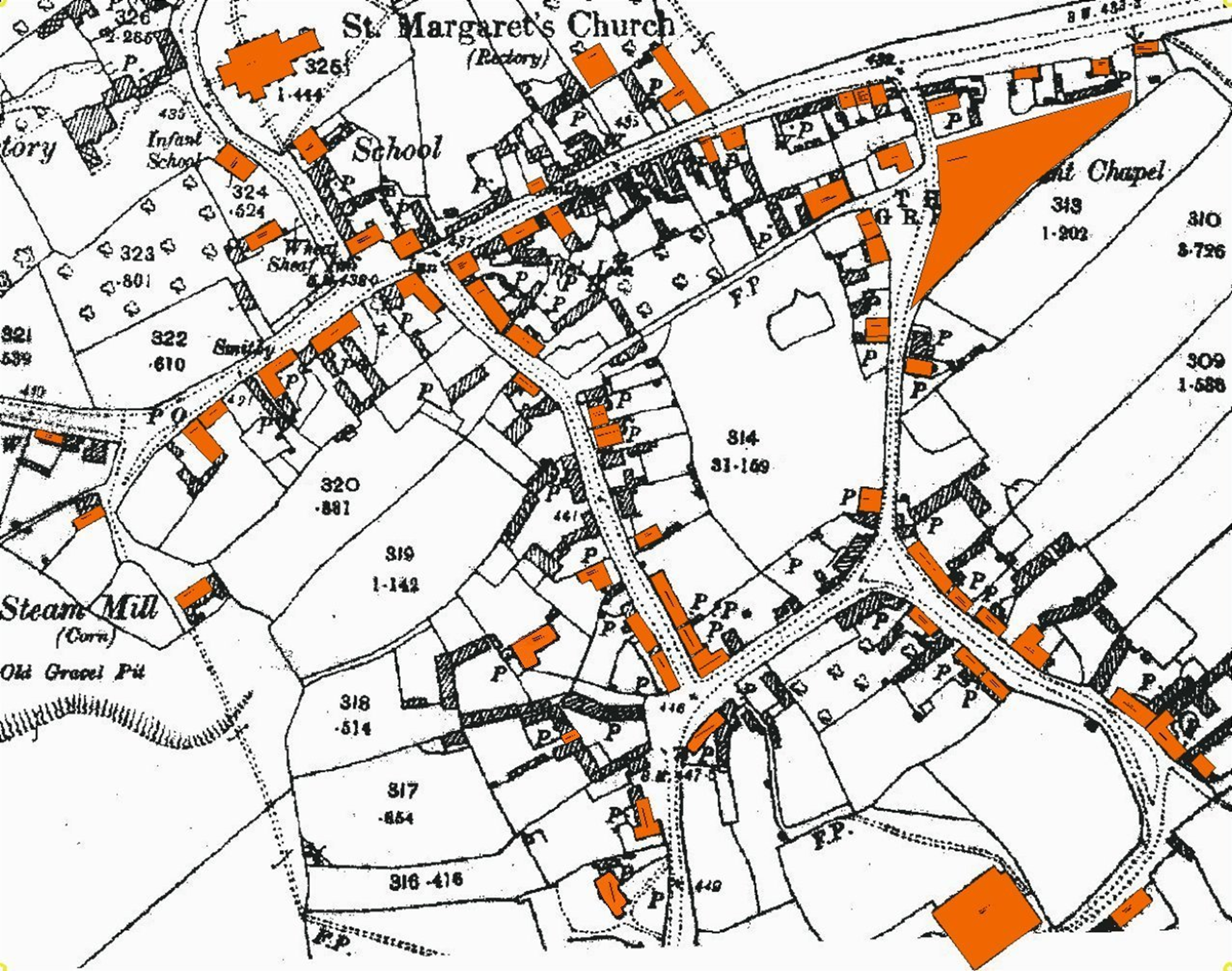 This map shows the central area of Crick. House HistoryRecords are available for:
- Boat Horse Lane, No.5
- Chapel Lane, Nos. 6/7
- Church Street, Nos. 1-3 (the Manor)
- Church Street, the Old School
- High Street, No. 8 (Curfew House)
- High Street, No. 9 (Hill Farm)
- High Street, Nos. 16 &18
- High Street, No. 19 (Spencer House)
- High Street, No. 27 (Phoenix House)
- High Street, No. 31 (Hunters Gap)
- High Street, No. 33 (Owen Dicey's Shop)
- Lauds Road, No. 7
- Lauds Road, No. 18 (Lilac Cottage)
- Lauds Road, No. 19 (Woolcomb Adams Farm)
- Lauds Road, No. 29 (Hghfields Farm)
- Lauds Road, No. 31-33 (Furlong House)
- Main Road, No. 15 (The Wheatsheaf)
- Main Road, No. 17, (Maltings)
- Main Road, No. 23
- Main Road, No. 28 (Well Cottage)
- Main Road, No. 37 (Home Close, aka Fairview)
- Main Road, No. 38 (Hillside)
- Main Road, No. 42 (Northgate House)
- Main Road, No. 56
- Main Road, No. 62 (The Retreat)
- Main Road, No. 76
- Main Road, No. 78
- Main Road, No, 80 (Woodbine Cottage)
- Main Road, No. 86 (Post Office, formerly Flying Horse)
- The Derry, No. 2
- The Derry, Mill House
- The Marsh, No. 1
- The Marsh, No. 2
- The Marsh, No. 4
- Watford Road, No. 6 (Vynter's Manor)
- Watford Road, No. 8, (Frant Lodge)
- Watford Road, land around former brickworks
- Watford Road, Hillcrest
- Watford Road, Mill Hill House

Statements in Crick's manorial rolls from the reign of Elizabeth the First mention that one of the village husbandmen named Ledger Banbury was leasing a close of land known as 'Brice's Close' in the 1550s.
Comparison of later documents (such as the Enclosure Award of 1778) and deeds for land and property dating from the 1800s, together with study of the modern Ordnance Survey map, show that this close was located alongside the road from Crick to West Haddon, which would have been a route for livestock being moved between pastures and market.
House HistoryRecords are available for:
- West Haddon Road, Home Farm
WILLS & RECORDS
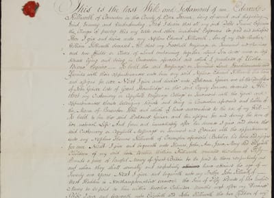
Transcribed Early Wills
The period between 1500AD and 1700AD may also be explored via the wills that have survived for those earlier years. All available extant wills for Crick in the period 1500-1700 (and also for the neighbouring villages of Ashby St Ledgers, Barby, Braunston and Kilsby) have therefore been digitally recorded and transcribed by local historian Gren Hatton, in an attempt to make up for the lack of early parish registers.
Contact the Archivist for further information.
Church Burial Records
Crick is very fortunate, in that the Church of England registers exist in almost complete state from the 1550s up to the present day. The church of St Margaret of Antioch dates from the Saxon period and incorporates extensions in the 12th, 14th and 15th centuries, together with restoration work in 1840 and 1910.
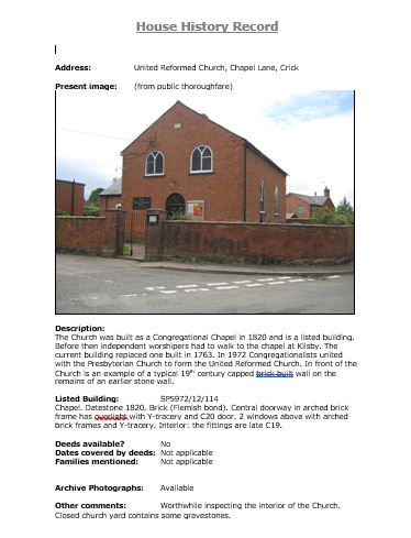
The United Reform Church in Crick (which for many years was known as the Congregational Church) has its origins in the 17th century, when local non-conformists began to meet in large private houses for worship. In the 1700s they acquired a piece of land, the site of a Protestant dissenting meetinghouse, and in the early 1800s it was decided that a new church should be built. The current building was completed in 1820, and regular services have been held ever since. A major renovation in the early 1900s provided comfortable seating for 120, and in the 1960s the schoolroom was extended to provide a versatile meeting room. In 1972 the Congregational Church joined with the Presbyterians to form the United Reformed Church.
We hold the transcribed Church graveyard inscriptions (the graveyard is now closed); these records do not include the present burial ground or the URC's (closed) graveyard. The mapping of the graveyard is a future project.
Should you require details of more recent records from Crick Burial Ground (which is a council responsibility), please contact the clerk of Crick Parish Council. Click here for contact details.
Parish Records
The database of Crick parish register transcripts are maintained by the Rugby Family History Group. Click here for contact details.
CRICK TREACLE MINERS
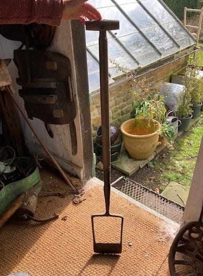
 CRICK TREACLE MINERS
Treacle mining was at its height in Crick during the 17th, 18th and 19th Centuries. While most mines had closed down at the start of the 1900s due to the competition from Mr Tate and Mr Lyle some smaller one-man mining operations have continued to meet the occasional demand for Real Treacle. As recently as 2000, Crick treacle was sold on the open market as part of the Crick Millennium Festival.
The outstanding characteristic of Crick Treacle is its sweetness but by some it is reputed to be an aphrodisiac. Treacle Miner's Spade
Very little remains by the way of surviving documents and most of our evidence is anecdotal. Given the harsh life-style and that the practices of Crick treacle mining were passed down the generations by word of mouth and on the job training, this is understandable. However, below we have pieced together some information.
Research into the ways of Crick’s Treacle Miners and their families is ongoing. If you are able to provide any factual or anecdotal evidence on the Crick Treacle Miners, please contact us.
Acknowledgement. The source of much of the information below is a research report dated 1/4/2023 by Dr Nogram, Dr B Renrut, Jen Ny-Gee and Reg J Doog OBF based on interviews carried out between 1995 and 2004.
ORIGIN OF THE SEAMS
ORIGIN OF THE SEAMSTreacle seams were probably first formed during the mid-Jurassic Period, which spanned approximately 50 million years, 199 to 149 million years ago. This period was also known as the “Age of Reptiles”.
The generally accepted theory of treacle seam formation is that it is the result of geologic processes occurring over long periods of time. Most natural treacle formation began when large tracts of vegetation and forest formed across much of the Great Britain. Notably amongst the vegetation was a plant called ragus-ragusis giaganticus, a sugar cane type plant the size of a giant tree, which secreted vast amounts of sweet sap. This sap accumulated and partially solidified. In the absence of decomposition, it was buried under sediment. Over time, the accumulated material became buried deeper underground. The effects of heat and pressure caused the material to be compressed and solidified into treacle bearing rock.
Over millions of years the land was formed as the various layers were raised and folded. In parts of Great Britain the treacle strata emerged near the surface and sometimes it remained deep underground.
The Crick seam is roughly located on the route of the Jurassic Way, which follows along the eastern Parish Boundary. The Crick Treacle Miners were fortunate that the seams reach close to the surface.
For more information: Mining and extraction , Miner's Health , Crick Mining Co-operative or BACK
Mining and Extraction
MINING AND EXTRACTIONUntil the end of the Victorian era, reading and writing was not universal as it is today and was available to only those who could afford to pay to be taught. So little would have been written down and the practices for treacle extraction and processing would be passed by word of mouth and by example set by father to son. Rather like the Free Miners of the New Forest, treacle mining involved family groups and for this reason the skilled practices for mining and processing the ore remain vague today.
A frequently asked question is - how were treacle seams located? It is believed that the children of a miner’s family were made to follow the behavior of wasps in the fields. Wasps gathering together in a spot where there was no visible nectar source could indicate the likelihood of good treacle find. However, in some areas, you only have to look in the fields where the farmer has been ploughing, to discover a fresh harvest of lumps of treacle rock. Often these lumps of treacle rock are difficult to recognise, the lumps usually being plastered with mud. However, a quick wipe over with a handkerchief and a taste of the rock with the tip of the tongue is a simple test anyone can make.
There can be little doubt that the 1776 enclosure act, which put land into the hands of individuals and ended the open fields system of farming, had the effect of increasing treacle mining activities in Crick. The co-operative spirit of the open field method of farming would have continued after enclosure. It is alleged that treacle mining was mainly a clandestine operation but there is little doubt that after 1776 with land being in private hands there was an increased opportunity for small scale drift mining in Crick.
In Crick quantities were extracted in blocks. The thick viscid syrup with the consistency of molasses was extracted from the blocks by a simple pressure extraction process using a treacle press made from local coppice material. Early presses were no more than layers of straw and ore below a wood and heavy stone mass. Later a screw press like a cider press was introduced.
For inferior ore bearing rock, heat was used to extract the molasses. Great care was needed as anyone who has dropped sugar into a fire will know. Often the rock would be heated over the fire in a cauldron held by a free-standing tripod. The liquid would be ladled out.
One problem of heating the rock beside the tendency for material to ignite if overheated was the telltale dark smoke, which like the smoke from the moonshine whisky still, was a tell-tale sign to be avoided.
For more information: Origin of the seams , Miner's Health , Crick Mining Co-operative or BACK
MINER'S HEALTH
MINER'S HEALTHAn occupational disease particular to Crick Treacle Miners was said to be Erythema Sucrosis. If a highly adulterated seam was tapped there would be a flow of raw treacle around their legs. This was at a time before the invention of the modern “gum” boot and miners would wear leather jack- boots that did not protect from the treacle permeating their feet and ankles. Excessive exposure to the molasses would cause an angry bulbous eruption on the soles of the feet.
A description by an early 19th Century Physician has survived.
“A poor wretch was carried to my rooms at midday swearing most damnably that he had contacted St Anthony’s fire, and that if his torment was not assuaged he would end his miserable existence in the Navigation.
I relieved him of two pints of blood to correct these morbid fancies and observed the afflicted members discovering a ruddy festering eruption from toe to ankle with premonitory signs of incipient mortification of the lesser two digits of the left foot. I applied a Salve – viz

twice daily to the affected parts, within ten days the fiery inflammation was subdued and another week effected a complete cure.”
The condition is now rarely seen due to improved working conditions and modern local medical therapy quickly controls the odd sporadic case.
For more information: Origin of the seams , Mining and extraction, Crick Mining Co-operative or BACK
CRICK MINING CO-OPERATIVE
CRICK MINING CO-OPERATIVEIt is easy to be nostalgic and take as romantic view of the life of Crick’s Treacle Miners but theirs was a hard but honest existence. Very little has survived in the way of hard records but a poster from 1872, found in a house in Crick in the 1970’s, showed this to be true. On the poster is a compensation claim for a miner who had sustained injuries; it is remarkable to see the community spirit we take for granted in Crick today existed within the treacle miners from the very beginning.
Whole families retained the knowledge, there was good economic reason to pool their knowledge and resources in a co-operative manner and as numbers expanded the Crick Treacle Mining Company emerged to combine and protect their livelihood.

For more information: Origin of the seams , Mining and extraction , Miner's Health or BACK
Contacts
Crick History Society General Inquiries
Crick History Society Archivist
Rugby Local History Research Group Rugby Family History Group
Old Archived Crick Website (not fully functioning) - West Northants History/Crick